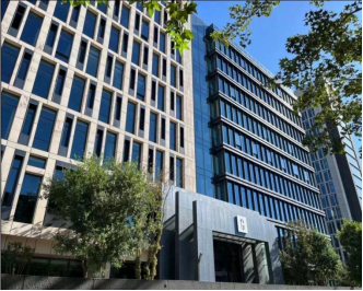
Beijing Digsur Technology Co., Ltd. (hereinafter referred to as "Digsur Tech") is a company that envisions integrated air - ground digital twin applications. It is committed to becoming a leading operator of low - altitude airspace supervision and service platforms as well as a service provider of spatiotemporal digital twin cloud platforms. Digsur Tech focuses on unique application scenarios such as integrated air - ground digital twins, cultural heritage digital twins, and battlefield environment and situation analysis. It integrates data, software systems, and hardware into its unique products. Gradually shifting from spatial data acquisition, processing, and application to spatial data cooperation and operation, Digsur Tech aids in the national digital development and high - quality development as a national "little giant" enterprise with specialized, refined, unique, and innovative features.
Founded in 2004, Digsur Tech has its headquarters and research and development center in Beijing and has established several branches (subsidiaries) in places like Xi'an. It is now a national high - tech enterprise and a Zhongguancun high - tech enterprise. It has also been honored as an outstanding innovative unit by the Chinese Society for Surveying and Mapping, is among the top 100 enterprises in China's geospatial information industry, and serves as the host and secretary - general unit of the China AOPA Low - altitude Economic Development Working Committee. Additionally, it is a standing director - level member of the "Safe Development" Council of the Civil Aviation Administration of China, a record - filing unit for flight procedure design of the Civil Aviation Administration of China, and the only unit in China with dual qualifications for military and civil aviation flight procedure design. It is also the host unit of the General Aviation Branch of the China Air Transport Association's Navigation Service Professional Committee and the Cultural Heritage Protection Professional Committee of the Chinese Society for Surveying and Mapping. Digsur Tech has been approved to establish the Beijing Municipal Corporate Technology Center, a Beijing Municipal Intellectual Property Pilot Unit, a Post - Doctoral Scientific Research Workstation, and the Digsur Tech Association for Science and Technology. It has been rated as one of the top 100 enterprises in China's geospatial information industry for nine consecutive years and was selected into the "Top 100 Chinese Low - altitude Economy Enterprises" list by the TaiBai Think Tank in 2024.
Digsur Tech holds a full set of Class A qualifications in surveying and mapping geographic information, Class A qualifications in engineering investigation, land planning qualifications, airport flight procedure design qualifications, and more. It owns over 60 invention patents and software copyrights and has received over 40 honors, including the First Prize for Scientific and Technological Progress in Surveying and Mapping by the Chinese Society for Surveying and Mapping, the Gold Award for Outstanding Surveying and Mapping Project, and the First Prize for Scientific and Technological Progress by the China Geospatial Information Industry Association.
With 21 years of in - depth experience in the field of spatial and geographic information, Digsur Tech integrates satellite remote sensing, aerial surveying and mapping, ground - surface precision surveying, underground geological exploration, the Internet of Things, big data, and other technologies. It is dedicated to the data acquisition, integrated application, and continuous operation services of geospatial information. The company provides high - quality and continuous technical services for fields such as integrated air - ground investigation and planning design, urban and rural planning and natural resources, urban and rural construction and smart cities, agriculture and rural revitalization, cultural heritage protection, transportation and water conservancy, culture and tourism, emergency management, and ecological environment. It also offers technical services for airport construction, including air flight procedure design, operation rule argumentation, airport site layout, airport construction consultation, compilation of aeronautical charts, airport clear airspace and electromagnetic environment assessment, two - and three - dimensional aerial surveying and mapping, and real - scene 3D modeling.
Digsur Tech has core technologies in multi - source data processing, air - ground integrated modeling, spatial grid encoding database, and dynamic service computing. It has developed the "Deep Engine Spacetime Cloud Platform" with independent intellectual property rights, which covers real - scene 3D applications and extends to integrated air - ground digital twin applications. This platform supports a series of spatiotemporal information systems for the Lingjing series, such as digital protection of cultural heritage, air - ground integrated smart transportation, airspace control and monitoring, and smart city construction, covering the entire industry chain.
